Find your hardiness zone
Enter a ZIP code to find its USDA zone and the local conditions that shape planting.
Growing context
These estimates become local after ZIP lookup.
USDA hardiness map
Select a zone on the map for its winter temperature range.
Loading live GIS zone layer...
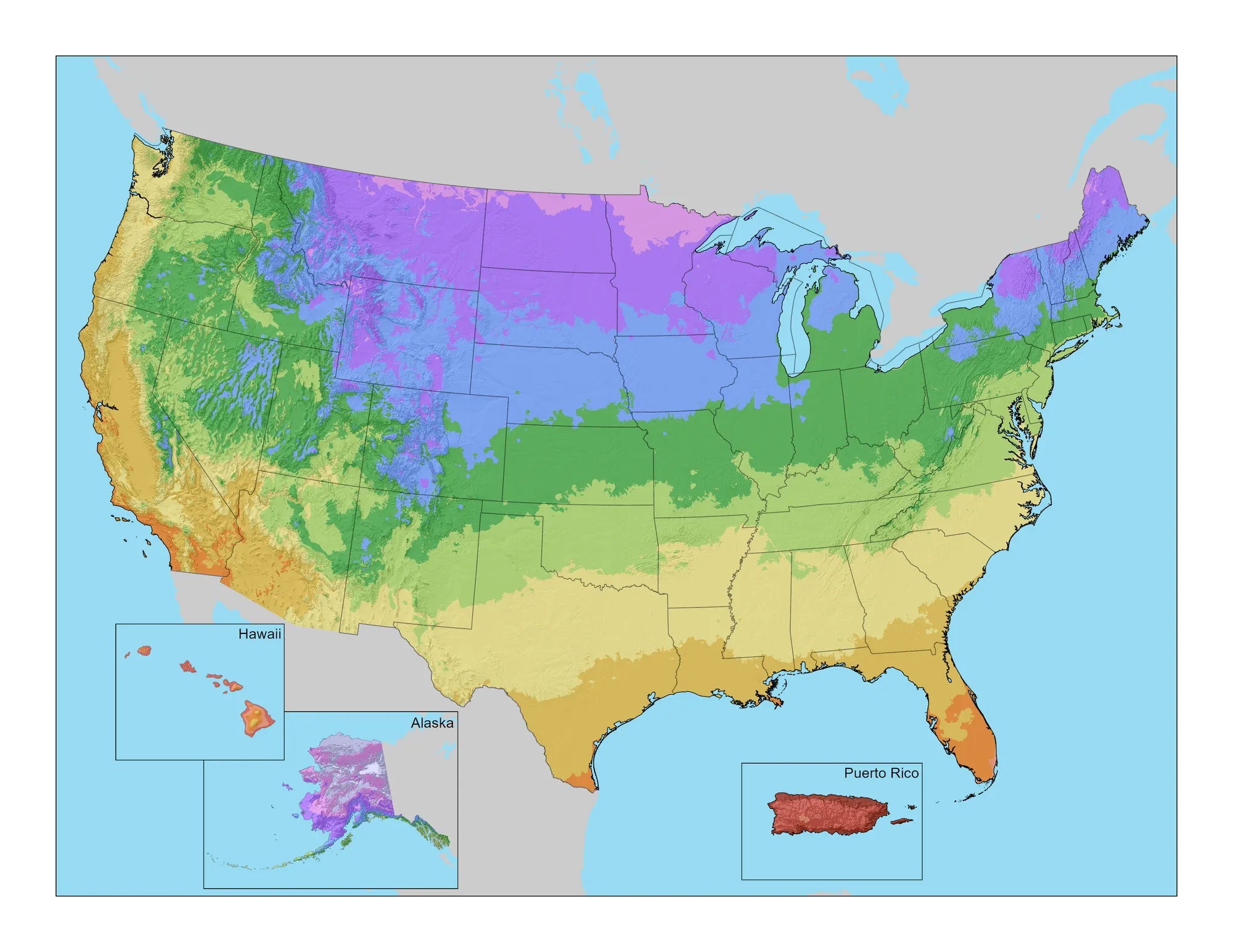
Official USDA ARS 2023 national map layer. ZIP pin is approximate; local terrain, exposure, and drainage can shift real garden behavior.
Map legend and limitations
Short season / cold winter Cold-hardy temperate Long shoulder seasons Warm winter / heat-driven
Not shown by hardiness zone: summer heat humidity soil drainage chill hours deer pressure native range frost pockets
Browse hardiness zones manually
Zone temperature ranges
Select a zone to review its average annual extreme minimum temperature.
Plants for this zone
After ZIP lookup, this panel shows zone-fit starters from the plant database and links into the matcher or calendar.
Enter a ZIP code to see useful plants and planning moves for that zone.
Data sources and methodology
Interactive zone overlay uses public ArcGIS vector tiles adapted from USDA/OSU 2023 hardiness data and feature data derived from USDA ARS 2023 Plant Hardiness Zone Map data. Static fallback image is from the 2023 USDA ARS Plant Hardiness Zone Map downloads. Selected plant overlays use Plant by ZIP database hardiness ranges; they are suitability estimates, not county-level native range maps. ZIP and local climate overlays are approximate planning context.